
In The 9 Most Extreme Places on the Planet, WebEcoist sought out the most superlative locations on the Earth in nine nifty categories. This renewed look at our exceptional planet uncovers nine more extreme locations that rate their own place in the sun… rain, wind, snow, etcetera.
The Oldest
(images via: Daily Mail UK and Mahjoob)
There are several candidates for the Earth’s oldest rocks located in Greenland, South Africa and Australia but the Nuvvuagittuq Greenstone Belt in northern Canada seems to be the reigning age champion.
(image via: The Pirate’s Cove)
These rocks date back approximately 4.28 billion years to the Hadean Eon, a hellish time when our planet’s crust was just beginning to cool, and meteorites and comets rained from the skies. It’s estimated that the impact of a Mars-sized proto-planet called Theia occurred several hundred million years earlier, adding to the earth’s mass and forming the Moon.
(images via: PopAstro and GalaxyWire)
The “oldest rock on Earth” may actually be a moon rock! The so-called Genesis Rock, picked up off the lunar surface by astronauts during the Apollo 15 mission, is estimated to be 4.5 billion years old and may have once been part of the Moon’s original crust.
The Rainiest
(images via: Tutunendo, Patatastraigo and Travelvista)
You might expect the rainiest place on Earth to be in a rainforest and you’d be right: the Colombian Department (province) of Chocó, bordering Panama, is widely recognized as being the wettest place in the world. How wet is Chocó? In 1974, the town of Tutunendo was drenched with an astounding 26,303 mm (86 ft, 3.5 inches) of rain! On average, Tutunendo receives 11,770 cm (463.4 inches, or 38 ft, 6 inches) of rain per year and 2/3 of the time the rain falls at night.
(images via: Plan Your Adventure and Hanaleikauai Activities)
Mount Wai-‘ale’ale on the island of Kauai, Hawaii has the most rainy days per year: up to 350 rainy days annually. Keep that in mind before you book your next vacation to “sunny Hawaii”.
The Snowiest
(images via: Wikipedia, Dgrin and WS/DOTblog)
Extremely heavy snowfalls occur in parts of the world where tall mountains divert moisture-laden air masses upward, bringing them past their condensation points. Exceptionally heavy snowfalls can occur in some surprising places: on February 14, 1927, researchers measured the depth of the annual snowpack on Japan’s Mount Ibuki at 38.8 feet (11.82 m). The Cascade Mountains of America’s Pacific Northwest are the recorded snowfall champions, however.
(image via: Stone Creek Lodge)
Snow on Washington state’s Mount Rainier was measured at a record 93.5 feet (2,850 cm) in the winter of 1971–72. Mount Ranier’s record was broken over the winter of 1998-99 when 95 feet (2,896 cm) of snow fell on the nearby Mt. Baker Ski Area. We’ll assume the snow-making machines got a rest that winter.
(images via: Dark Roasted Blend, English Russia and France24)
While snowfall in upper mountain elevations rarely inconveniences anyone except skiers, heavy snowfalls can paralyze urban centers for days, sometimes weeks. The above images of towns in Russia and the Ukraine digging out from massive snowstorms show what a visit from General Winter can be like… foreign invaders, take heed (and snowshoes).
The Driest
(images via: Nunuk Photos, Up Overland and Run Further)
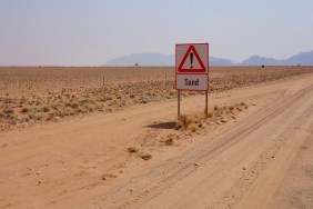
Chile’s Atacama Desert doesn’t get much rain at the best of times, and at the worst of times which is, actually, most of the time) it gets barely any. It’s been noted that at the town of Arica, no rain at all fell between October 1903 to January 1918 – longest recorded rainless period in the world! Some parts of the Atacama strongly resemble photos of the planet Mars, which is not really a surprise as it doesn’t rain there either.
(images via: GhostTowns, Petzlaff and Historic 66)
America’s Death Valley often makes lists of the hottest, lowest and driest places but the Mojave Desert can be just as hot and dry. Indeed, the longest recorded dry spell in the USA was at Bagdad, California (appropriate name, that) – 767 days, from October 3rd, 1912 to November 8th, 1914. I doubt they had a white Christmas then, and they won’t now: Bagdad’s been a ghost town since 1991.
The Windiest
(images via: 180782’s Blog, New Zealand Travel and State Library of NSW)
Commonwealth Bay is officially listed in the Guinness Book of World Records and the Eighth Edition of the National Geographic Atlas as being the windiest place on Earth – and to make matters even worse, it’s located in Antarctica. Forget about the occasional gust, the winds at Commonwealth Bay are strong, steady, and blow at 150 mph (240 km/h) – or more.
(image via: AAD)
Australian antarctic explorer Douglas Mawson established the main base of the 1912 Australasian Antarctic Expedition expedition at Cape Denison, at the mouth of Commonwealth Bay. Presumably he did this on a rare windless day; otherwise he must have been insane.
(images via: Home By The Sea and Brian A Small)
One of the windiest places on Earth’s northern hemisphere is Cape Blanco in southwestern Oregon, USA. Jutting into the Pacific Ocean near Coos Bay, Cape Blanco is both the westernmost point of Oregon and the contiguous United States. Severe winter storms often rake Cape Blanco with shrieking winds that gust up to 125 mph (200 km/h).
The Flattest
(images via: Rajie Manders, WikiTravel, Home of POI and Horolezec)
Bolivia’s Salar de Uyuni was formed from several prehistoric lakes that converged and dried, leaving a salt pan several feet thick or more over a 4,086 sq mi (10,582 sq km) expanse. Think of Utah’s Bonneville Salt Flats multiplied by 25 and you’ll get an idea of how large the Salar de Uyuni is.
(image via: Seaway Blog)
Certain rare elements are concentrated in the various salts that make up the Salar, especially the strategic metal Lithium – up to 70 percent of the world’s lithium reserves are locked in the Salar’s salts!
(images via: Gone For A Wander and Travel Bolivia)
Normally dry and virtually lifeless, the Salar de Uyuni comes alive each November when summer rains attract flocks of pink flamingos, who feed on red algae and brine shrimp. At these times, the Salar becomes even flatter – in effect, it becomes a virtual mirror orbiting satellites use to calibrate their distance measurements.
The Deepest Cave
(images via: Gilyn, The Horse and Rider and Karavi)
Located in the politically ambiguous Republic of Abkhazia, the Voronya Cave (Crows’ Cave, in Russian) plunges 7,188 feet (2,191 m) into the depths of the Arabika Massif, a limestone formation dating back to the Age of Dinosaurs. Also known as the Krubera cave (after Russian geographer Alexander Kruber), the cave was discovered in 1960 and has surpassed Austria’s Lamprechtsofen as the world’s deepest cave and the only known cave deeper than 2,000 meters (6,561.5 ft).
(image via: Avibo)
Credit must be given to the the Ukrainian Speleological Association for establishing a series of depth records in the Voronya Cave and its many subsidiary caves. Beginning in the early 1980s, the Ukr.S.A. began deliberately clearing blockages and expanding squeeze points so that cave explorers could penetrate ever deeper into the interconnected caves. The current record depth of 7,188 feet (2,191 m) was set in the autumn of 2007 but as the Ukr.S.A. mounts annual expeditions to the Voronya Cave system, it’s possible those figures could change.
The Most Remote Land
(images via: Stuff, Explorapoles and PolarIce)
A “pole of inaccessibility” is that point on a continent that is the greatest distance from any ocean in any direction – the North American PofA is in South Dakota. There’s a hierarchy among poles of inaccessibility, however, and the most inaccessible of all lies in the frigid wastelands of Antarctica.
(images via: N/US Traverse and Break Media)
In 1958 the Soviet Union established a base at the Antarctic Pole of Inaccessibility which they quickly abandoned. Before leaving the base, the Soviet team installed a golden bust (OK, it’s plastic) of Lenin to oversee the icy landscape and mark the USSR’s global reach. Lenin’s eyes gaze back wistfully in the direction of Moscow – on the bright side, he won’t be troubled by pigeons. Below the bust, nearly inundated by years of snow, is a small hut that contains a guest book for visitors to sign. I’m guessing it’s a very thin periodical.
The Most Remote Island
(images via: Wikimedia, Lo Incognito, Mappery and Hotel Club)
Our previous Extreme Places on the Planet article featured the Most Remote Inhabited Island, Tristan de Cunha. Though certainly remote, another uninhabited island holds the distinction of being the most remote, period. Bouvet Island is a small island in the South Atlantic Ocean that, oddly enough, is under Norwegian sovereignty. The nearest land is Antarctica’s Queen Maud Land nearly 1,000 miles (1,600 km) to the south. The nearest inhabited island is Tristan da Cunha, 1,404 miles (2,260 km) away and the nearest inhabited land is South Africa, which is 1,600 miles (2,580 km) to the northeast. Fun facts about Bouvet island: it served as the setting for the 2004 film Alien vs. Predator. Bouvet Island also has its own (unused) Internet country code top-level domain: bv.
(image via: Robin Muench)
Bouvet Island is 93 percent ice-covered with glaciers calving into the chill Southern Ocean. The island is only 19 square miles (49 sq km) in area and has no vegetation except for small outcrops of moss and lichen. Bouvet Island’s only claim to fame occurred in 1979 when an orbiting American spy satellite detected a double-flash of light near the island. Though never officially confirmed, the flash is believed by many to be the signature of a joint Israel-South Africa nuclear test.
(image via: Borders.com)
Extremes of weather, distance, geology and geography make our planet exceptional in many ways. Nothing interesting in your world today? Step out of your comfort zone sometime, going to extremes can have its own reward!


